 Mele Sax-Barnett will be hosting the OpenStreetMap Editathon PDX meetup at Urban Airship this Saturday (the 19th). Details on Calagator: http://calagator.org/events/1250464914
The large room downstairs is reserved for most of the day (from 10AM - 5PM), so feel free to come and go as you please. There will be an Intro for beginners around noon, and some suggested tasks will be provided. Food and beverage sponsorships are welcomed. Otherwise, please plan on bringing your own or taking a break to stop by one of the various food spots nearby. 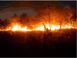 Graduate Student Research Assistantships Available for an NSF Funded Research Project on Fire in Africa
We have 2 positions available for two years of funding for our Masters program in Geography at CSU, Long Beach. Spring Admission Deadline: October 31st Position 1. Remote Sensing: The ideal candidate will have experience with remote sensing/ image processing software such as ERDAS or ENVI or e-cognition software. The research will involve mapping savanna vegetation cover and fire scars. Position 2. GIS spatial analysis: The ideal candidate will have experience with environmental GIS applications using ESRI spatial analyst software. The research will involve mapping savanna vegetation and fire scar patterns and changes. For more information contact: Dr. Paul Laris Chair of Geography California State University , Long Beach plaris@csulb.edu  The Portland State University's Geospatial Information Society will be hosting our first colloquium of the year in this Friday, Oct.18, 3:00 to 4:00 PM in Cramer Hall room 413. Our speaker will be Dr. Greg Townley, a PSU Psychology professor specializing in community psychology, with particular interests in community integration of individuals with psychiatric disabilities; supported housing interventions and homelessness; and the relationship between culture, sense of community, and well-being. Dr. Townley utilizes a variety of social-environmental research methods in his place-based research, including Geographic Information Systems (GIS), neighborhood assessments, and qualitative/ ethnographic approaches. He also collaborates with local and international partners to implement and evaluate interventions addressing homelessness, supported housing, and mental health service delivery.
Please join the PSU Geospatial Information Society this Friday to support Dr. Greg Townley in presenting his work using Geographic Information Systems (GIS) in Psychology research. Click here to see the event flyer.  GIS Specialist
Pratt Institute Posted: 10/10/13 Description Responsible for providing data gathering, analysis, and mapping technical assistance for community-based planning, sustainability, and economic development projects. Responsible for creating professional- quality maps and data visualizations. Responsibilities: - Utilize ArcGIS, web mapping tools and graphic design software to deliver high quality data collection, data analysis, and graphic illustration of data with a focus on community planning, sustainability and economic development data analysis. - Create spatial data from various tabular sources including U.S. Census data and NYC Open Data. Design professional quality maps using ArcGIS and coordinate the visualization of data in Policy and Planning reports. - Contribute research and expert opinion on acquisition of secondary resources, software and hardware that support planning and policy work applicable to GIS analysis. - Manage Pratt Center's spatial data library. - Coordinate all data and mapping-related tasks with senior staff. - Assist staff planners and specialists in providing community planning outreach, materials design, and implementation for community planning, sustainability and economic development projects. - Supervise and train interns. - Perform other duties as assigned. Qualifications: Education: Master's degree in urban planning or equivalent is required. Experience: At least two (2) years' professional experience in urban planning, with a focus on data gathering, analysis, and reporting. Community planning and outreach experience a plus/ Skills: Required skills include: data management, analysis, visualization; strong cartographic skills; project management; community outreach; strong written/oral communication and presentation skills. Must have expertise in ArcGIS; experience with Adobe Creative Suite a plus. Other: Team player, sense of humor and mission driven mind-set desired. Salary: Commensurate with experience To Apply: In order to be considered please submit a resume, a cover letter that includes salary history and expectations, and the names and contact information for three professional references. PRATT INSTITUTE IS AN EQUAL OPPORTUNITY EMPLOYER AND RECOGNIZES AND VALUES THE BENEFITS OF A DIVERSE WORKFORCE. How TO APPLY: Please apply Directly via Pratt website: https://pratt-edu.silkroad.com/epostings/ About Organization: Founded in 1887, Pratt Institute is the second largest independent college of art, design, and architecture in the United States and the largest in the northeast, offering undergraduate and graduate degree programs in its schools of architecture, art and design, information and library science, and liberal arts and sciences. Pratt is located on 25 landscaped acres in the Clinton Hill section of Brooklyn and has a Manhattan campus in an eight-story renovated building on West 14th Street. Pratt offers 24 undergraduate degree programs and 26 master's degree programs.  The Nature Conservancy in Seattle is looking for a Spatial Analyst. Follow the link below to the Nature Conservancy's career page and search for Spatial Analyst or Job # 41535.
https://careers.nature.org/psp/P91HTNC_APP/APPLICANT/HRMS/c/HRS_HRAM.HRS_CE.GBL  Department of Natural Resources GIS Web Mapping Steward
Information Technology Specialist 3 - ITS 3 Recruitment # 2013-10-7259-10660 Salary Range: $4,114 - $5,395 per month plus comprehensive benefit package including retirement The GIS web mapping steward is responsible for managing web-based GIS applications for the Aquatic Resources Division (AQR) within DNR. This position will work closely with DNR's IT department developing and publishing map services as well as stewarding and maintaining various aquatic resources web mapping applications. The position is responsible for managing GIS applications for the Washington Marine Spatial Planning effort. It will also work with other AQR staff and state and federal agencies in the development and stewardship of a Washington State Bathymetry Composite Data Model. This position reports to the Aquatic Resources GIS Unit Supervisor. REQUIRED QUALIFICATIONS:
For more details and information and HOW TO APPLY, CLICK HERE http://agency.governmentjobs.com/dnr/default.cfm?action=viewJob&jobID=742641. OR GO TO: http://agency.governmentjobs.com/dnr/default.cfm?action=viewJob&jobID=742641 Questions? Please contact Tim Strickler at 360 902-1341 or e-mail us at DNRrecruiting@dnr.wa.gov.  Save the Date
For the 2014 GIS In Action Conference, April 16th & 17th Save the date for the Twenty-Second Annual GIS In Action Conference, hosted by the Columbia River Region of the American Society of Photogrammetry and Remote Sensing (ASPRS) and the Oregon-Southwest Washington Chapter of the Urban and Regional Information Systems Association (URISA). Plan to attend this amazing opportunity to meet, network, and reconnect with GIS professionals from the region. We look forward to seeing you there! We will be back at Portland State University (PSU) in downtown Portland, OR. Check our website for information about last year’s GIS In Action Conference to get ideas about abstracts, posters, and more. A call for abstracts will go out in early November, so get them ready! Any other questions about the conference please check back at our website, http://www.orurisa.org/GIS_In_Action,or contact Keith Massie at: Keith.Massie@cityofmedford.org  An instructor is needed to teach a 2-credit advanced GIS course spring term at Washington State University Vancouver campus. The course would be tutorial-based, focused on techniques relevant to grad students working on selected research projects. These students will have already taken our Intro GIS course (EnvSci 486/586). There are likely to be 10 or fewer grad students in the course. For more information, please contact Cheryl Schultz.
Cheryl B. Schultz Associate Professor School of Biological Sciences Washington State University Vancouver 14204 NE Salmon Creek Ave. Vancouver, WA 98686 Office: 360-546-9525 Lab: 360-546-9082 schultzc@vancouver.wsu.edu http://research.vancouver.wsu.edu/cheryl-schultz  LIVE GIS Seminar Event #5: Understanding GIS Databases
As you know, a new GIS curriculum is taking shape on ConservationTraining; six new courses ranging in topic from the five functions of a GIS to managing your spatial data to creating a map product. One new learning component has been created for each of these new courses, the live seminar event. We are really excited about the LIVE events. The live seminar events will be held via WebEx technology and presented by several of the course authors. Understanding GIS Databases was released about a month ago. The live seminar event for this course will be held next week on Tuesday October 15, 2013 at Noon Eastern Time. This live seminar event will be open to the ConservationTraining community and will consist of demonstrations highlighting functionality discussed within the associated course. The live seminar event will be recorded and posted to the Understanding GIS Databases course room. Click here to see the new course Understanding GIS Databases. Click here to attend the LIVE GIS Seminar Event on October 15, 2013 at Noon Eastern Time.  ASPRS Columbia River & Puget Sound Regions
17th Annual Technical Exchange The technical exchange is an informal opportunity for people interested in Photogrammetry, Remote Sensing, and GIS to learn more about how these fields are being applied in resource management, government, academia, and business within our region. This day-long event is a great opportunity to hear local practitioners and students present a 20 minute talk on one of their current or recent projects, as well as make new contacts or refresh old ones. Date: 25 October 2013 Time: 9:00am to 3:00pm (Set-up time available for presenters: 8:00am to 9:00am) Location: Vancouver Water Resources Education Center, 4600 SE Columbia Way, Vancouver, Washington 98661, 360-696-8478 Parking: Ample free parking is available on site Registration/Abstract Deadline: 11 October 2013 ** Fill out and submit the registration form here ** See the attached form for credit card payments. Anyone interested in attending or wishing to share information about their work is welcome. No commercial presentations or endorsements are allowed. We particularly want to encourage non-members to come find out more about ASPRS. As an encouragement, the registration fee will be waived for student attendees who wish to join ASPRS on the day of the exchange. |
Categories
All
Archives
March 2024
|
 RSS Feed