|
https://www.governmentjobs.com/careers/oregonmetro/jobs/4234213/safety-data-gis-specialist-limited-duration
Position summary This is a limited duration full-time position expected to last two years. This is subject to change. Metro is dedicated to shaping a better future for the greater Portland region. The work the people of Metro do every day benefits the lives of the people who live here, today and tomorrow. We offer a highly competitive compensation and benefits program. Learn more about the benefits Metro offers. Metro, the regional government in Portland, OR serves the nearly 1.7 million people of the region by providing services for land use and transportation planning, housing and homeless services, GIS and research, natural areas, parks and trails, solid waste and recycling and visitor venues like the Oregon Convention Center and Oregon Zoo. Data plays an important role in understanding and guiding policies, programs and decisions that our community members make; great data informs great decisions. In recognition of this, Metro’s Data Resource Center (DRC) collaborates with local partners to develop and deliver the Regional Land Information System (RLIS). RLIS provides nearly 200 layers of spatial data that support strategic decision-making for governments, businesses, and organizations across our region. RLIS is a valuable public asset which promotes data accessibility and informs our choices and decisions. Metro’s Regional Transportation Plan has a goal to eliminate traffic deaths and life changing injuries. As the Safety Data GIS Specialist, you will support Safe Streets for All grant activities by creating, maintaining and improving safety-related datasets that are part of or will be a part of Metro's enterprise data in RLIS. You will also develop and analyze data that will help the public, elected leaders, decision makers, cities and counties understand why serious crashes are occurring and solutions to make streets and highways in the metropolitan area safer for everyone. If this sounds like you – someone who wants to work with a supportive team of spatial data specialists to work on safety-related analysis to benefit the community by helping to reduce transportation-related serious injuries and deaths on our streets, then we invite you to apply. As the Safety Data GIS Specialist, you will:
Attributes for success:
Diversity and inclusion: At Metro, we’re committed to hiring a workforce representative of the communities we serve, recognizing that a diverse workforce strengthens our organization. We invest in employees by supporting equitable and inclusive hiring practices, employee policies and training programs. TO QUALIFY We will consider any combination of relevant work experience, volunteering, education, and transferable skills as qualifying unless an item or section is labeled required. Please be clear and specific in your application materials on how your background is relevant. Minimum qualifications:
Remote work: The Planning, Development and Research Department supports a flexible, hybrid work environment. Residency in Oregon or Washington is a requirement for employment. https://stantec.jobs/portland-or/gis-analyst/B07FDA13D3494D7FA5A71306175B4919/job/
GIS Analyst - ( 230003UZ ) Description Strong teams do not just happen—they are built. Stantec teams are creatively imagined, collaboratively planned, and readied to face tomorrow with optimism. Our experts lead their fields, collaborating on projects that are as technically challenging as they are impactful, creative, and fulfilling. We are a place where you can apply your passion—and find endless opportunities to align to your professional growth while making your communities more equitable, resilient, and livable. Here at Stantec we are pushing the boundaries of innovation, and we are now pursuing a highly motivated and technically capable GIS professional to join our Geospatial Discipline within the Water Delivery business unit. We collaborate closely with our colleagues and clients to meet the challenges they face within the water resources and related industries, including energy, transportation, risk assessment, environmental management, sustainability, and resiliency. Many of the world’s top engineers and scientists come together in our Water business because they view a community’s interaction with water a bit differently—as a single holistic system, rather than unconnected networks divided by jurisdictional boundaries. Working throughout the hydrologic cycle, we are delivering sustainable solutions to make sure water is where it should be and available when needed. Our experts guide our work with scientific rigor, an innovative spirit, and a vision for growth. Every day, we help communities improve, reuse, and protect this precious resource for future generations. By 2025 we’re hiring 2,000 people (like you) to join our team. Grow with us, H2O+U. Your Opportunity The selected candidate can be based at one of the Stantec offices across the western U.S., and we offer flexible work arrangements (e.g., in-office, hybrid, virtual). Preference would be one of the following locations: Spokane, Boise, Portland, Bellevue, Denver, or Sacramento. Your Key Responsibilities
Qualifications Your Capabilities and Credentials
Education and Experience
Pay transparency laws require employers to provide the following information for positions that may be in the following jurisdiction(s): Salary Range(s): 62,800.00 - 91,100.00 (CA, CO, WA locations only) The final agreed upon compensation is based on individual education, qualifications, experience, and work location. At Stantec certain roles are bonus eligible. Benefits Summary: Regular full-time and part-time employees have access to medical, dental, and vision plans, a wellness program, health saving accounts, flexible spending accounts, 401(k) plan, employee stock purchase program, life and accidental death & dismemberment (AD&D) insurance, short-term/long-term disability plans, emergency travel benefits, tuition reimbursement, professional membership fee coverage and paid family leave. Regular full-time and part-time employees will receive ten paid holidays in each calendar year. In addition, employees will be eligible to accrue vacation between 10 and 20 days per year and eligible for paid sick leave (and if more generous, in accordance with state and local law). Temporary/casual employees have access to 401(k) plans, employee stock purchase program, and paid leave, in accordance with state and local law. The benefits information listed above may not apply to union positions because benefits for such positions are governed by applicable collective bargaining agreements. Primary Location : United States-Washington-Spokane Other Locations : United States-Washington-Bellevue, United States-California-Sacramento, United States-Colorado-Denver, United States-Idaho-Boise, United States-Oregon-Portland https://floanalytics.applicantpool.com/jobs/1028880.html
GIS Analyst -Seattle/Portland/Remote FLO Analytics (FLO) is searching for a GIS Analyst to join our team. As one of our GIS Analysts, you will be responsible for supporting school district, local government, and utility projects; performing spatial data analysis, developing workflows and creating maps; and using your GIS expertise to help the communities we work in. Every day, you will design and implement GIS solutions, manage projects to deliver products and services within budget and deadlines, and collaborate with team members. As a GIS Analyst, you will...
To thrive in this role, you must have...
Other technology you'll work with:
Who we are... FLO specializes in Geographic Information Systems (GIS) and data analytics services, catering to government, school districts, utilities, and non-profit organizations across the Pacific Northwest and beyond. We're proud to be a subsidiary of Maul Foster & Alongi (MFA), an employee-owned consulting firm renowned for its expertise in environmental science, engineering, planning, communications, and GIS. Join us at FLO and MFA for the benefit of your career, your community, and these incredible perks:
Our hiring process for this position
Compensation Range: $71,000 to $100,000 per year Applications will be reviewed on a rolling basis! Here at MFA, we celebrate diversity and actively encourage women, people of color, LGBTQ+ individuals, people with disabilities, members of ethnic minorities, foreign-born residents, and veterans to apply. MFA is a proud equal opportunity employer, and we are committed to being an inclusive environment for all employees. Employment decisions are based on job requirements, business needs, and individual qualifications. All qualified applicants will receive consideration for employment without regard to race, color, religion, sex, sexual orientation, gender identity, national origin, age, disability, marital status, military service, or any other status protected by laws and regulations. https://www.governmentjobs.com/careers/portlandor/jobs/4226159/gis-technician-ii-multiple-vacancies?keywords=gis&pagetype=jobOpportunitiesJobs
The City of Portland is seeking GIS Technician II’s to join the team! This eligible list may be utilized to fill current vacancies within Portland Parks and Recreation and future vacancies within the Bureau of Planning and Sustainability. Job Appointment: Regular, Full time Work Schedule: Monday - Friday 7am-3:30pm Work Location: In person at The Portland Building 1120 SW 5th Ave. There is opportunity for limited telework. Benefits: Please check our benefit tab for an overview of benefit for this position. Union Representation: PROTEC17 (PTE17). To view current City of Portland labor agreements, please click here. Application Material: Please click APPLY to submit your application via the City of Portland’s online portal. You will need to attach a resume and answer supplemental questions. About the Classification: GIS Technician IIs are experienced users of GIS software, including the ArcGIS software suite and ArcGIS Online. These positions are skilled at schema development, data conversion, data editing, map design, and other functions. GIS Technician II’s are utilized in a variety of bureaus including Portland Parks and Recreation, the Bureau of Planning and Sustainability, Bureau of Environmental Services, Portland Bureau of Transportation, Portland Water Bureau, and the Bureau of Development Services. If you apply & meet minimum qualifications, you will remain eligible for future opportunities within this classification for the duration of the eligible list. Please review the current position information below, along with a general description of how other bureaus utilize GIS Technician IIs. Position Summary: Use your GIS skills help us grow the urban forest for all Portlanders! This position will join the collaborative Science, Outreach, and Planting team at Portland Parks & Recreation Urban Forestry to manage a complex geodatabase comprising hundreds of thousands of records, create and maintain tools for data collection and project management, and provide analysis, mapping, and support to staff and other end users within the ESRI Enterprise environment. This role is a great opportunity for a GIS professional to use a variety of skills to figure out solutions for dynamic and expanding programs. The ideal candidate will have education and work experience with expertise in GIS, databases, user support, and scripting. Funding for this position is supported by the Portland Clean Energy Fund, as part of a historic investment in expanding tree planting and climate justice in Portland. This role will expand capacity for growing and implementing a large-scale equity-focused tree planting program and supporting internal and external users of GIS-based tools and data. For more information on this innovative program, please visit the PCEF website. What you’ll get to do:
As a person, you are:
About Urban Forestry and Portland’s Forest: Urban Forestry's mission is to manage and ensure Portland’s urban forest infrastructure for current and future generations. Portland’s urban forest is valued at over $6 billion and comprised of over 1.2 million park trees, 218,000 street trees and 2.9 million private property trees. The Urban Forestry's team is responsible for the overall management, stewardship, and improvement of this essential infrastructure system. Urban Forestry’s work includes delivery of sustainable and equitable forest services to all Portlanders; establishing and enacting best management practices, plans, policies and technical standards for tree care and protection and urban forest expansion; implementing, enforcing and proposing improvements to the City’s tree regulations; providing tree maintenance services including 24/7 response to tree emergencies on City properties and public streets; tree planting and expansion of urban forest services; measurement and assessment of urban forest coverage, health and services; offering community education and stewardship programs; and oversight and support of the City’s volunteer advisory tree board. Portland is a Tree City USA for 45 years, a Tree City of the World and the Urban Forestry program is accredited by the Society of Municipal Arborists. S&F Land Services is looking for a future team member who wants to expand their survey skills, take on more responsibilities, grow as an individual and increase their professional value. We focus on customizing job positions for each team member’s skills and passions - so they can focus on what they do best.
If you are interested in working for a group who recognizes that the success of the company is based on the success of each of our team members, then let’s sit down and start putting together your plan for a rewarding and successful career. S&F Land Services is seeking individuals with experience in the profession of land surveying. If you have experience, we encourage you to apply. We also perform Remote Sensing (Drone based Imagery/LiDAR and Terrestrial Imagery/LiDAR). If have experience in these applications or are eager to learn – you could join a team leading the industry in combining Land Survey and Remote Sensing. All Remote Sensing applications at S&F are overseen by a Certified Photogrammetrist and Advanced Mapping Specialists. You would be joining a group of over 12 Professional Licenses Surveyors. S&F’s survey team is passionate about the noble profession of Land Surveying and look to hire individuals who share that passion. We focus on mentoring, training and continued education of our staff. The successful candidate must possess:
In addition to traditional survey methods, S&F Land Services is leading the industry in adopting UAS/drone survey, terrestrial scanning, and mapping – with in-house professional land surveyors and photogrammetrist/remote sensing scientist overseeing the workflow. The successful candidate will incorporate conventional and remote sensing methods into the daily workflow. S&F Land Services is a growing Survey and Remote Sensing firm with offices located throughout the Western states and is led by energetic, innovative licensed Professional Land Surveyors who pride themselves on providing excellent work environments, customer service to engineers, project owners and representatives, and public infrastructure agencies at City, State and Federal levels. We have a passion for the noble profession of land surveying, and it shows in our communication and deliverable. S&F provides services for private residential and commercial development, electrical transmission infrastructure both federal and private, municipalities, transportation related projects, and tribal surveys following CFedS requirements. The variety of projects and services we provide leads to a unique work environment. For the successful candidate, S&F will provide relocation assistance along with the potential for a signing bonus. S&F offers a competitive benefits package consisting of medical, dental, vision, vacation and holiday pay, and 401k Investment Plan (company matching). www.sflands.com/careers https://www.governmentjobs.com/careers/portofportland/jobs/4213938-0/gis-developer
General Information At the Port of Portland, we use everything we have – our three airports, four marine terminals, five business parks, and all the resources, expertise, and experience behind them – to move with purpose, connecting people with powerful opportunities and creating value for our region. We know that every person we hire, business we work with, contract we sign and decision we make is a chance to make someone’s life better. And we’ll use our power and influence to pull down barriers, unlock new opportunities, ensure more people share in our region’s success and include those who have been excluded in the past. With YOUR help – together with our partners, customers, and community – we’ll help drive meaningful change! We are seeking an individual with advanced professional and technical skills to design, develop, and implement, custom Geographic Information System (GIS) related software and supporting solutions critical to the Port of Portland’s geospatial business activities. This is exciting work that involves technologies required to host and maintain GIS services on-premises and in the cloud. Are you a highly motivated and organized individual? Do you enjoy being part of a high-drive, fun, and knowledgeable team? If so this might be the job for you! The Port offers a competitive benefits package, including retirement through the State of Oregon Public Employees Retirement System (PERS), and a collaborative and diverse work environment. In this position, you’ll have an opportunity to work a hybrid schedule typically working two days in office (at the PDX airport) each week with the remainder working remote. When you’re in the office, you’ll be in a modern, open building with an amazing view of Mt. Hood and inbound and outbound flights right outside our windows! Summary of Essential Responsibilities
Minimum Requirements/Skills and Abilities
Skills and Abilities:
https://www.eventbrite.com/e/dvs-portland-making-numbers-count-with-karla-starr-tickets-722571078547? Join us for a talk, workshop and community building event with Karla Starr - acclaimed science and business writer, speaker and author of the book Making Numbers Count: The Art and Science of Communicating Numbers. Thank you to Ziba Design for hosting us in their beautiful auditorium! Registration is available here or in the PDX Data Visualization meetup group: https://www.meetup.com/pdx-data-visualization/events/296132905/ 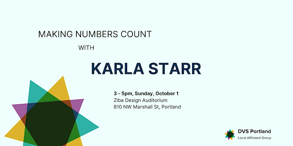 https://tetratech.referrals.selectminds.com/jobs/gis-analyst%E2%80%93-portland-or-honolulu-hawaii-35402
Discover your full potential. At Tetra Tech, we are collaborating with industry-leading experts for a sustainable future for our world. We combine consulting and engineering with advanced analytics and technology to solve the world’s most complex challenges. Our innovation hubs across the globe will enable you to share ideas and best practices while growing your professional network. Wherever you are in your career journey, you will benefit from working with world-class engineers, scientists, and technical specialists. Apply today and join the company that is Leading with Science®. Tetra Tech’s commitment to hiring the best talent in the industry and helping them thrive professionally is stronger than ever. We are seeking a qualified GIS Analyst to support work at its Portland, OR and Honolulu, HI offices for geospatial data processing, and figure/map generation for a variety of biological and natural resources programs. Candidate could be located in Portland, Oregon or Honolulu, Hawaii. The successful candidate will function in a support role under a Lead GIS Manager and will be responsible for supporting a variety of our natural resources projects. A multidisciplinary science-based background is desired. The majority of work will be office-based. Responsibilities: · Provide a strong and dependable GIS support role for natural resource data analysis. · Prepare hard copy and electronic figures and field maps in ArcGIS. · Perform geospatial data management, analysis and documentation. · Identify published sources and downloading spatial data in support of natural resources projects. · Compile metadata documentation to FGDC and related standards. · Perform geodatabase design, maintenance and documentation. · Collect, download, correct, and export GPS data from Field Maps, Survey123, Collector. Requirements: · College degree desired (Geography preferred) · 1-5 years related experience. · Proficiency with data management, organization, and a willingness to learn. · Pertinent experience working with ESRI’s ArcGIS v10.xx software; ArcGIS Pro preferred. · GPS field data collection and analysis experience using Field Maps/Collector · Proficiency with MS Office Suite. · SQL database experience desired (Microsoft SQL Server) · Flexibility and adaptability to meet fast-paced demands. · High motivation and an ability to work independently and as part of a team. · Possess good oral and written communication skills. · Must be multi-task oriented and possess excellent problem-solving skills. · Employee is expected to maintain a professional manner in all aspects of their work. · Must have a valid driver license and be able to pass the company DMV check to be a Tetra Tech-qualified driver of corporate/rental vehicles. · A Pre-employment drug screen in compliance with state regulations is required. At Tetra Tech, health and safety play a vital role in our success. Tetra Tech’s employees work together to comply with all applicable health & safety practices and protocols, including public health orders and regulations that are mandated by local, state, provincial, federal, international authorities, and clients. About Tetra Tech: Tetra Tech combines the resources of a global, multibillion-dollar company with local, client-focused delivery in more than 550 locations around the world. Our reputation rests on the technical expertise and dedication of our employees—27,000 associates working together to provide smart, scalable solutions for challenging projects. We are proud to be home to leading technical experts in water, environment, infrastructure, resource management, energy, and international development. https://www.usajobs.gov/job/749825400
About the Position Serves as Realty Specialist with assignments primarily focusing on Management and Disposal actions of Federal real property with In-leasing and Acquisition duties as assigned. Incumbent is responsible for planning, implementation and accomplishment of actions for civil works real property including land, structures, crops, and natural resources covering a large geographic area located in one and/or two states (Oregon and Washington). Duties
https://oregon.wd5.myworkdayjobs.com/SOR_External_Career_Site/job/Portland--DOGAMI/Mapping-Geologist---Natural-Resource-Specialist-2_REQ-136653
Initial Posting Date: 09/06/2023 Application Deadline: 09/20/2023 Agency: Department of Geology and Mineral Industries Salary Range: $4,073 - $6,230 Position Type: Employee Position Title: Mapping Geologist - Natural Resource Specialist 2 Job Description: Opportunity Awaits, Apply Today! - Mapping Geologist (Natural Resource Specialist 2) This position exists in the Geological Survey & Services (GS&S) program. The GS&S program conducts geoscience surveys of the state, serves as the cost-effective centralized source of geoscientific information in Oregon for the public and for government, and forms partnerships for the effective use of that information to reduce risk. As the Mapping Geologist you will gather, evaluate, analyze, map, and interpret earth science information to inform the management of natural resources and help identify and understand the geology and geohazards at local, regional, and state-wide levels. Additionally, you are responsible to coordinate and collaborate with Project Managers in the development of project scope, conducting research and writing technical reports, in support of short and long-term geological fundamental and applied research investigations. As part of the Oregon Resilience Plan, this position advances resiliency through innovative communication techniques and technologies to inform the public and stakeholders of Oregon’s unique and complex geology and geologic hazards. For a full review of the position description, please click here. What We Are Looking For Minimum Qualifications:
NOTE: If you are using education to meet the minimum qualifications, a photocopy of transcripts will be requested prior to hire. Desired Attributes:
|
Categories
All
Archives
June 2024
|
 RSS Feed